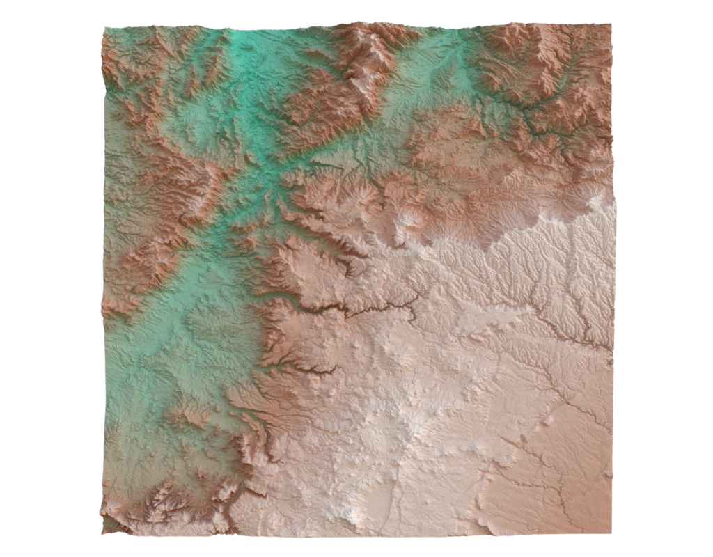
Topographic Map
This example aims to generate a 3D topographic map from elevation data provided by USGS.

Data
The input is height field image representing a tile of the US elevation map (N35 and W112) downloaded from USGS. It is converted to a dense quad mesh using this script.
Code
#!/usr/bin/env python

import hakowan as hkw
from image2mesh import image2mesh

# Step 1: Generate a mesh from a heightmap.
usgs_data = image2mesh("data/USGS_1_n35w112.tif")

# Step 2: Create a map layer that maps elevation to color.
# Note that we use a custom colormap here.
usgs_map = (
    hkw.layer(usgs_data)
    .material(
        "Principled",
        hkw.texture.ScalarField(
            "elevation", colormap=["#15A887", "#8C4E37", "#E9ECF2"]
        ),
    )
    .transform(hkw.transform.Compute(z="elevation"))
)

# Step 3: Render from two different angles.
config = hkw.config()
config.sensor.location = [0, 0, 3]
hkw.render(usgs_map, config, filename="results/usgs_1_n35112.png")

config.sensor.location = [0, -2, 2]
hkw.render(usgs_map, config, filename="results/usgs_1_n35112_side.png")